Earn an Online MS in Geographic Information Science at Calvin University
Map your future with the only online Master of Science in GIS offered at a Christian university. Ranked #14 nationally by UniversityHQ, ahead of programs ten and twenty times our size.
Calvin's online MS in Geographic Information Science is built for working professionals, career changers, and Calvin undergrads who want technical mastery of spatial data alongside a thoughtful perspective on how that data should be used. The program is fully online and asynchronous, costs $720 per credit, and can be completed in 9 to 24 months. Curriculum is built on the industry-standard UCGIS GIS&T Body of Knowledge. No GRE required.
Why Earn an MS in GIS from Calvin?
Here’s why earning a Master of Science in Geographic Information Science from Calvin's nationally ranked program is a smart, future-focused choice:
- Ranked #14 nationally. Calvin's online MS in GIS is ranked alongside programs from Johns Hopkins, UW-Madison, NC State, and USC, schools with student bodies twice to twenty times Calvin's size. We are the top-ranked program in Michigan and the top-ranked program for our size.
- Leading Christian online MS in GIS in the country. Calvin is the leading Christian university where you can earn a Master of Science in GIS online. That distinction matters because GIS sits at the center of real ethical questions: privacy, surveillance, mapping in conflict zones, the use of spatial data in policing and public health. Our curriculum doesn't avoid those questions, it teaches you to navigate them. Students from any background are welcome; the faith dimension shapes how we teach, not who can enroll.
- Built on the UCGIS GIS&T Body of Knowledge. The University Consortium for Geographic Information Science publishes the field's standard curriculum framework. Calvin's program is built directly on it, which means what you learn here aligns with what employers, certification bodies, and other institutions in the field expect.
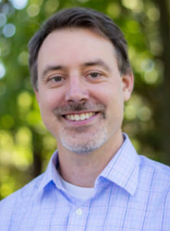
- Faculty who do the work. Program director Dr. Jason VanHorn earned his PhD at Ohio State under Dr. Mei-Po Kwan, widely considered the foremost GIS researcher in the world. His own research applies GIS to counter-terrorism analysis, cartographic philosophy, and physical geography. The full faculty includes tenured professors and adjuncts with active careers in the field.
- Hands-on with the technology that defines the field. You will train on ESRI ArcGIS Pro, Python for geospatial analysis, drones for remote sensing, and 3D terrain modeling, through a virtual lab component built into every course. This is not a theoretical program.
- Loading...
At a Glance
Complete in 9-24 months
Cost per credit
No GRE required
Course spotlights
Remote Sensing of Earth
Explore how satellites, drones, and aerial photography help us study Earth’s landscapes—both natural and human-made. This course includes lab work and drone-based homework, with exciting topics like photogrammetry and 3D terrain modeling.
Geospatial Programming and Data Management
Learn to code with Python and build custom GIS tools using ESRI software and Map Objects. This course blends programming with practical projects, including designing a full GIS solution for a business or organization.
Business Location Intelligence
Discover how to use map-based data to pick winning business locations and ace market strategy, all while boosting a local nonprofit with a hands-on project that looks great on your resume.
Spatial Dynamics
Ever wonder how communities change over time? Dive into the real-world data behind shifting populations, economies, and health trends, then build a GIS mapping project of your own that shows exactly how humans leave their mark on the map.
What to expect
Calvin's online MS in GIS is built around hands-on application. Every course is structured around real scenarios in computer cartography, mapping science, and spatial data management. That practical orientation translates directly into the kinds of work our graduates do: local government, urban planning, environmental management, and intelligence and analytics roles.
Whether you are seeking a career shift, promotion, or a pathway to GISP certification, Calvin's program offers flexible entry points, including a 4+1 option for Calvin undergrads (apply in your senior year, take one graduate course before graduation, save time and tuition). You will graduate with the technical expertise the field requires and a faith-informed framework for thinking about how mapping and spatial data can serve your community.
How the Online Program Works
All courses are 100% asynchronous and fully online. There are no required synchronous class sessions, and there is no on-campus residency. You will work through structured weekly modules at your own pace within each course window.
Lab work happens through a virtual lab component embedded in each course. You will get hands-on experience with ESRI ArcGIS Pro, Python, drone-based remote sensing techniques, and other tools that match what GIS professionals use in the field.
You will collaborate with your professors and classmates through discussion forums, project reviews, and one-on-one consultations. Faculty are accessible by email and scheduled video calls.
Who This Program is For
Most of our students fall into one of three groups:
- Working professionals who want to add GIS expertise to a career in environmental science, urban planning, public administration, intelligence, public health, or local government.
- Career changers moving into geospatial technology from adjacent fields. A GIS background is helpful but not required; we admit students from a wide range of undergraduate backgrounds.
- Calvin undergraduates pursuing the 4+1 pathway, which lets you apply for early acceptance in your senior year and finish your master's in one additional year.
Career Possibilities
According to the Bureau of Labor Statistics, geographic information science is expanding at a steady pace of 5% per year. More than 1,600 new GIS careers will be available by 2029.
Regardless of your chosen career path, this program will provide you with the advanced skills and hands-on technology experience needed to achieve your goals.
Here are just some of the careers you could pursue.
GIS Analyst or Specialist – support local governments, utilities, or private firms with spatial data analysis and mapping.
Urban or Regional Planner – use GIS to inform zoning, infrastructure, and community development decisions.
Environmental Consultant – monitor ecosystems, manage natural resources, and assess environmental impact.
Drone Mapping Technician – collect and analyze aerial data for agriculture, construction, or conservation.
Public Health Analyst – map disease trends, healthcare access, and demographic data to inform policy and response.
Emergency Management Planner – support disaster preparedness, response, and recovery planning.
According to the Bureau of Labor Statistics, geographers earn a median annual salary of $92,040, and cartographers and photogrammetrists earn $76,720. The field is expanding at 5% per year, with more than 1,600 new GIS careers expected by 2029.

Have questions? Contact us!

The GIS master's program was excellent. I appreciated that the classes were practical and covered a wide variety of disciplines, from environmental topics to business analysis. Our professors are the best and I loved the collaborative work environment they created.

Featured Faculty Highlight
FAQs
Calvin University is accredited by the Higher Learning Commission (HLC). The Master of Science in GIS curriculum is built on the University Consortium for Geographic Information Science (UCGIS) GIS&T Body of Knowledge, which is the field's standard curriculum framework.
Tuition is $720 per credit. The program requires 30 total credits. There are no additional program fees, though you may have textbook and software costs. Financial aid and scholarships are available; ask the admissions team about the Master's Blessing scholarship for Calvin alumni.
Students complete the program in 9 to 24 months depending on whether they enroll full-time or part-time. Most working professionals choose part-time, finishing in 18-24 months. Full-time students can finish in 9-12 months.
No. Calvin does not require GRE or GMAT scores for admission to the online MS in GIS.
No prior GIS background is required. Most successful applicants come from undergraduate backgrounds in geography, environmental science, urban planning, computer science, public health, or military/intelligence work, but we admit students from any field. If you have GIS experience already, our enrollment team can advise on transfer credit; this program accepts transfer credits with program director approval.
Coursework includes hands-on training in ESRI ArcGIS Pro (industry-standard GIS software), Python for geospatial analysis, drone-based remote sensing tools, photogrammetry techniques, 3D terrain modeling, and spatial database design. Software access is provided through the program for the duration of your enrollment.
Graduates pursue roles as GIS analysts and specialists, urban and regional planners, environmental consultants, drone mapping technicians, public health analysts, and emergency management planners, in both public-sector and private-sector settings.
Calvin offers both a graduate GIS certificate and a master's degree. The certificate is a shorter, lower-cost path that focuses on core GIS skills; the master's adds research methodology, programming, advanced spatial analysis, and broader career flexibility. If you are using GIS in your current job and need to demonstrate competence quickly, start with the certificate. If you are pivoting careers or aiming for senior or specialized roles, the master's is the better fit. Credits from the certificate can apply toward the master's.
The program is fully online; international students living outside the U.S. can enroll without a student visa, but visa-required international students who want to study from inside the U.S. should contact admissions to discuss enrollment options.
Calvin is a Christian liberal arts university, and our perspective on faith shapes how we teach, particularly around the ethics of mapping and spatial data, privacy, surveillance, justice in mapping, and the use of GIS in conflict and crisis settings. Students of all backgrounds and beliefs are welcome. There is no requirement of religious participation or belief.
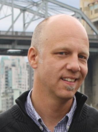
Additional Faculty


Ready to Apply?
Calvin accepts applications year-round on a rolling basis. The program starts in fall, spring, and summer terms.
Map Your Future with an MS in Geographic Information Science
Leverage spatial data to shape strategic, ethical decisions across sectors.