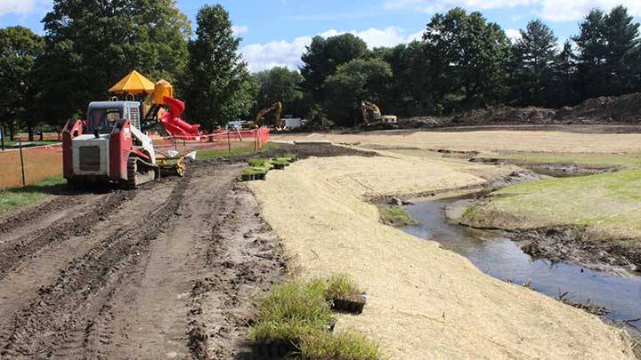
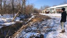
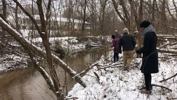
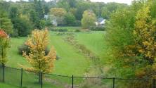
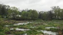
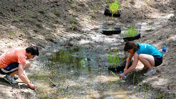
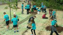
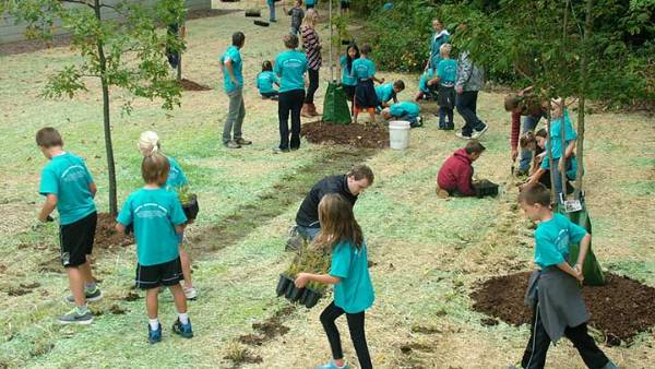
Dutton Shadyside Park floodplain restoration project
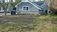
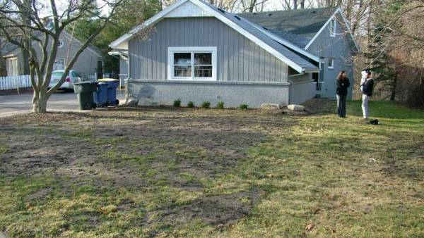
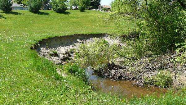
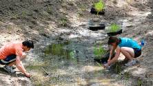
In the furthest upstream regions of the watershed, the runoff from agricultural fields, yards and roads flows down a network of ditches that joins together to make the main channel of Plaster Creek. Here at Shadyside Park is where the main channel begins to form. The creek meanders a half mile through this park. Before the restoration project, the banks of the creek at Shadyside Park were very steep and eroded. After a rain event, the creek would gush forcefully through the park eroding away the banks and contributing loads of sediment into the creek, in turn, degrading the stream and increasing flooding for downstream communities.
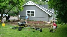
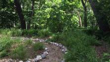
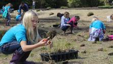
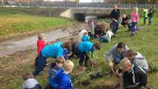
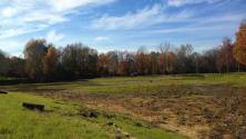
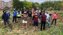
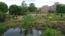
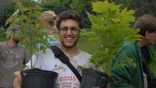
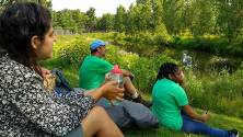
In partnership with Kent County Parks, MDEQ, and other partners, the steep banks were excavated into a more natural floodplain. This allows the creek to overflow into a wide area when the water level rises. The water can slow down, and deposit the sediment reducing erosion. With the help of hundreds of volunteers, Plaster Creek Stewards planted the floodplain with native Michigan plants. The native plants have deep root systems that allow water to percolate while holding soil in place. These plants will also attract native pollinators (like butterflies), birds, and other wildlife. Sadly, dozens of trees next to the creek needed to be removed for this project, but over 200 new trees were transplanted to beautify the park and increase the biodiversity. This project has been funded wholly or in part through Michigan Department of Environmental Quality’s Nonpoint Source Program by the United States Environmental Protection Agency.

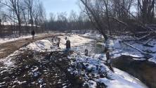
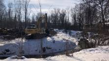
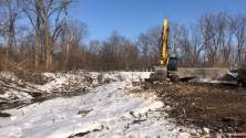
Leisure Creek Condo floodplain restoration project (January 2022-November 2022)
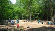
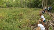
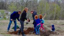
Located downstream from Dutton Shadyside Park, the creek banks at Leisure Creek Condominium Association suffer from many of the same issues as other locations along Plaster Creek—excessive erosion because the creek has become disconnected from floodplain habitats it used to overflow into. This project is like the Shadyside Park floodplain restoration: we aim to slow down the water, reduce erosion, and create habitat by creating a flood shelf. Upstream of the bridge, the steep banks along the south side of the creek will be excavated, and gently sloped to recreate a natural, healthy flood shelf and stable creek banks. This provides room for the creek to overflow onto the shelf when water rises. Water over the flood shelf will be slower, drop sediment, and reduce erosion. Once in the new floodplain, water will slow down, and slower moving water cannot carry as much sediment. In this way the floodplain will help remove sediment from the stream. Slower moving water also causes much less erosion.
The floodplain will be planted with thousands of Michigan native plants and trees by local school children, residents, Calvin University staff and students, as well as volunteers from all over the watershed. These plants will soak up water and transpire it through their leaves, further reducing the amount of water that is transported downstream. The variety of native plants will also increase habitat for pollinators, birds, and other creatures along the stream. As the new floodplain fills in, the sediment it removes will transform the main channel into better habitat for insects and fish who need a variety of habitats like rocky pebbles, pools, and diverse vegetation. Funding is currently being sought to complete the project downstream of the bridge in subsequent years. To get involved in the planting and care of this site, you can join us at our Fall Event.
This project has been funded wholly or in part through Michigan Department of Environment, Great Lakes, and Energy’s Non-Point Source Program by the United States Environmental Protection Agency.

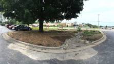
Silver Creek Overflow at Calvin Ave Basin
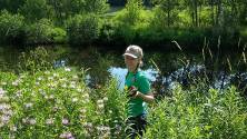
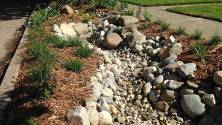
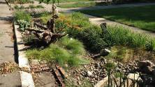
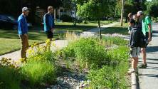
This original basin was designed in 1994 to address flooding and storm sewer surges but did very little to address water quality in the stream. Silver Creek Overflow Basin is engineered with a two-stage ditch and “pits and mounds” to give the creek room to spread out, catch stormwater and allow it to slow down and soak in the ground decreasing the pressure on the sewer and downstream areas (flooding). 107 species of deeply-rooted Michigan native plants help absorb water and filter contaminants while also providing needed habitat. In a community with little green space, this project welcomes nature into the neighborhood while preventing downstream flooding. It is a haven for birds, pollinators, small mammals, and aquatic creatures and improves the water quality for one of West Michigan’s most polluted waterways, Plaster Creek.
This project is part of a network of green infrastructure projects by local partners including Calvin University Plaster Creek Stewards, Kent County Drain Commission, the Lower Grand River Organization of Watersheds, and Grand Rapids Christian High School. The project was funded by the Great Lakes Restoration Initiative through the U.S. Environmental Protection Agency awarded to the Grand Valley Metropolitan Council.

Whiskey Creek Bioswale, Calvin University campus
This S-curved, multi-tiered bioswale receives the stormwater from a 2-acre parking lot used by students at Calvin University. The stormwater previously blasted into Whiskey Creek, a tributary to Plaster Creek, causing serious erosion and carrying chemicals and sediment that accumulated on the surface of the parking lot. Now the stormwater must slowly travel through a long, s-curved swale full of thirsty native plants and trees and rise to the level of a spillover pipe before entering a wetland where any extra water can be slowly released to the creek. This site has a trail network that visitors can hike on to see the bioswale as part of their visit to the Calvin University Ecosystem Preserve. This project has been funded wholly or in part through Michigan Department of Environmental Quality’s Nonpoint Source Program by the United States Environmental Protection Agency.
Kreiser Pond Bioswale
This large ponded bioswale slows and filters stormwater from the neighborhood streets upstream, 350 acres worth of stormwater. The surrounding banks and peninsula are planted with native trees and wetland plants that purify the stormwater while also providing habitat to native birds, insects and other wildlife. While this area is fenced off to the public for safety reasons, some school children have had permission to visit and use the area as a classroom, even in the wintertime. This project has been funded wholly or in part through Michigan Department of Environmental Quality’s Nonpoint Source Program by the United States Environmental Protection Agency.

Curb Cut Rain Gardens in Alger Heights, Garfield Park and Oakdale neighborhoods
Individual residential rain gardens throughout Southeast Grand Rapids are capturing and filtering stormwater off the streets, removing sediments and pollutants, and allowing water to naturally filter through the ground, slowed and cooled before it finally reaches the creek. These rain gardens are also a source of habitat and diversity in an urban setting--a way to welcome nature back to our urban spaces. A drive or walk down Paris Avenue, Jefferson or Hobart will give you a great variety of gardens. This project has been funded wholly or in part through Michigan Department of Environmental Quality’s Nonpoint Source Program by the United States Environmental Protection Agency.

Christian Reformed Church of North America denomination building, 28th Street
With a calling to care for creation, the CRCNA uses their property as a canvas for native habitat restoration. At the property you can see native plant gardens, rain gardens, a restored Oak Savanna, and a dry prairie. Many volunteer groups visit this site to learn about various native landscapes and to help with the restoration work.

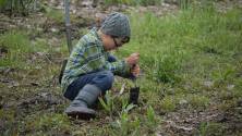
Residential Green Infrastructure Projects
Turning their yards into ecosystems, these homeowners have welcomed biodiversity into their communities. Kentucky Bluegrass transformed to prairie, a soggy wet area into a wetland, a parkway into a curb cut rain garden, or a creekside lawn into a restored floodplain, each site requires its own restoration “prescription” determined by soils, sun, and hydrology (water). We work with each homeowner to come up with a design plan and work with summer research students to implement the projects.